

The MapFinder app for iPhone and iPad
Developer: Ordnance Survey Limited
First release : 10 Jan 2013
App size: 332.97 Mb
The MapFinder app will remain for customers to use and access their purchased map tiles but unfortunately will no longer be updated with new features and content. For the latest and most up to date app from Ordnance survey search for ‘OS Maps’. This app also allows customers to download a digital version of their paper map, and view and subscribe to see all of the GB Ordnance Survey maps. OS Maps won the Digital Product of the year 2017 by the Outdoor Industry Association.
Please note: OS Maps and The MapFinder are not compatible and therefore purchases cannot be transferred between the apps.
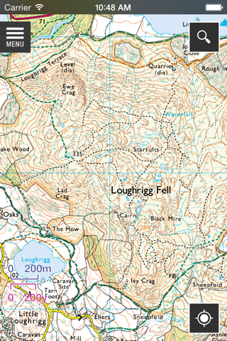
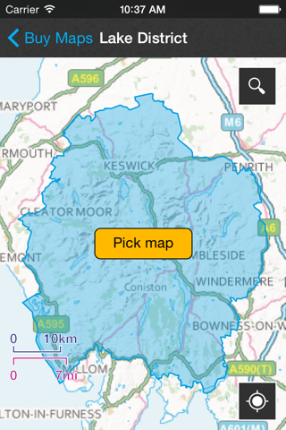
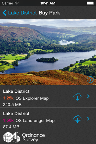
The MapFinder is a large download. With it, you can search our 1:250 000 scale road map by place name, postcode or address. You won’t even need an internet connection to search as it also works offline. Then, via the in-app options, you can buy the OS Landranger (1:50 000) and OS Explorer (1:25 000) close-up maps of the areas you’d like to focus on.
Despite our original commitment to maintain this application until April 2016, we have continued maintenance into 2017. Whilst we will no longer develop content and features going forward, the application will still be available for existing customers to continue to use their purchased content. As operating systems are updated the application may become less stable. For the most stable and up to date application from Ordnance Survey we would recommend the OS Maps app.
The MapFinder includes:
• A free overview of Great Britain at 1:250 000 scale
• Free road maps down to street level
• Options to buy high-resolution OS Explorer and OS Landranger maps
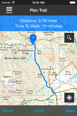
• Route recording and planning tools – record your routes in real time
• Route import and export functions
• Time, distance, OS grid references, latitude and longitude
• Select a route, see how long it will take on average to walk
• Place name look-up – postcodes and places in Great Britain
• Ordnance Survey grid reference look-up
• And useful tips on how to read and navigate maps
Customer Support
Our team is here to help if you get any problems with The MapFinder. If you can, check the FAQs first at https://www.ordnancesurvey.co.uk/shop/mapfinder.html, or contact us via our online customer service portal at https://www.ordnancesurvey.co.uk/contact/
App and Map sizes
The app is a large download. It has to save the maps and search database to your device. Please make sure your device has enough free space and you’re connected to a stable WiFi point before starting the download. The purchasable map sections are around 60MB each. If you want to save space, you can remove a purchased map section from your device, and then download it again (free of charge) when you next need it.
Continued use of GPS running in the background can dramatically decrease battery life..
Ordnance Survey is committed to creating the best mobile mapping experiences. We welcome your feedback and comments, and strive to act promptly on any complaints. Please get in contact with us via Twitter @OSLeisure, by phone on 03454 56 04 20
or via email at [email protected].